Photo by
permission of Ken Williams |
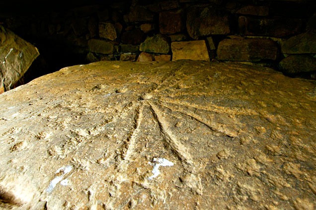
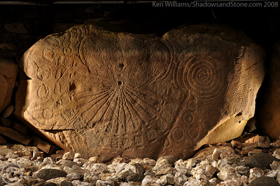
.... Kerbstone K15
- the so called "sundial" stone.....
N.L.Thomas (Irish symbols of
3500 BC, Mercier Press, 1988) has put forward an argument for K15 to be a
calendar stone. He suggests that the hole in the centre of the stone represents
the sun. Above, in the picked area of the stone inside the concentric arced
lines is a hole representing the moon, and the stars are the picked marks. The
twin arced lines indicating a solid shell over the earth to represent the
firmament. The radial lines are seen as the sun's rays reaching out to the
semi-circle of 16 squares which represent the 16 months of his proposed Neolithic
year.
The theory of the prehistoric 16 'month' year
The
Neolithic people in Ireland aligned their megalithic monuments at Brú na
Bóinne to the major solar events - the Winter Solstice, the Spring
Equinox, the Summer Solstice and the Autumn Equinox. These divided the year
into four quarters.
The half way points between these major solar events,
the cross quarter days, are Imbolc, Beltane, Lughnasadh and Samhain, which mark
the turning of the seasons and further subdivides the year into eighths.One
eighth of a year is approximately 45 days so a further subdivision gives
sixteen 'neolithic months' of approximately 22 days each.
|


.jpg)